Extrait d’une exploration d’un site, le logiciel Infraworks permet à partir d’une simple localisation sur une carte, de générer la topographie du site, en y montrant les routes existantes, les cours d’eau et parfois certains bâtiments, représentés en 3D. Le tout peut être transféré dans Civil 3D afin de faire une conception plus avancée, bien sûr on peut reporter cette conception dans le logiciel afin de mettre à jour la présentation.
This is an extract from a demo project I am working on using Infraworks 360, this software is part of a suite including Autocad, Civil 3D, Autocad Map 3D and others. By selecting an area on a map, much like Google earth, the software will extract base information to start a project by integrating roads, waterways, topographic data and if available buildings in 3D, you can take it to Civil 3D for design work and then export it back to update the presentation, more tools are available to do more design works and you can also integrate objects coming from other softwares, either GIS, Surfer or 3D Studio.
This is an extract from a demo project I am working on using Infraworks 360, this software is part of a suite including Autocad, Civil 3D, Autocad Map 3D and others. By selecting an area on a map, much like Google earth, the software will extract base information to start a project by integrating roads, waterways, topographic data and if available buildings in 3D, you can take it to Civil 3D for design work and then export it back to update the presentation, more tools are available to do more design works and you can also integrate objects coming from other softwares, either GIS, Surfer or 3D Studio.
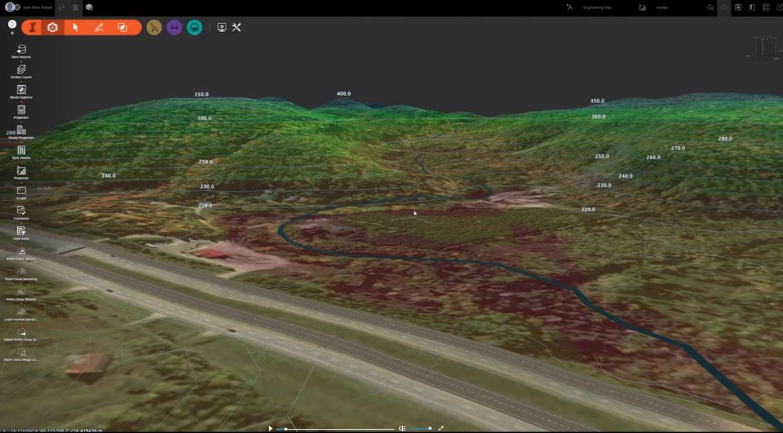
On peut également y intégrer des fichiers 3D Studio ou des éléments tirés de logiciels tiers comme QGIS, ArcMap, Surfer, etc.. On peut également faire une présentation en survolant le site ou en se plaçant à un endroit et suivre une trajectoire afin d’explorer le modèle.
You can also do a fly by animation to explore the area.
You can also do a fly by animation to explore the area.
 Flux RSS
